Skip to content
Search
Menu

We earn a commission if you book through this link. You pay the same price.

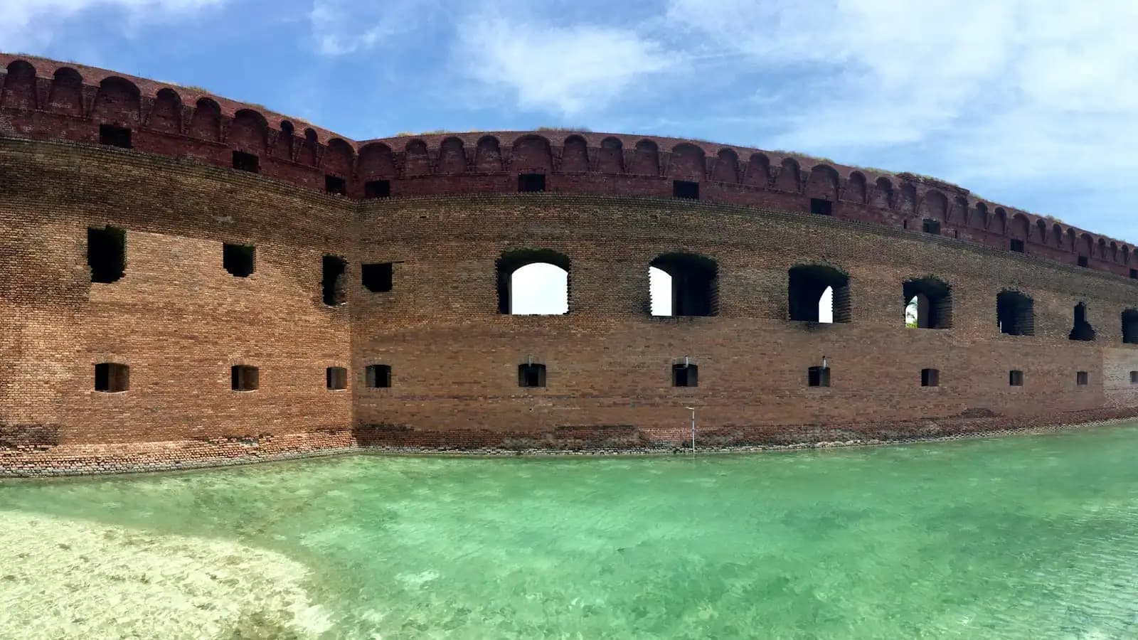
A red-brick coastal fort wall rising straight out of shallow green water under a blue sky
Unsplash

Things to Do

Ship Island: Where the Gulf Water Actually Is

Last updated

Ship Island lies twelve miles off the Mississippi coast and holds the clear Gulf water the mainland does not. Ferry season, the fort and how to plan it.

Almost everyone who books this coast arrives with a picture in their head of clear green water, and almost everyone finds something else. The sand along US 90 was pumped there by engineers in the early 1950s and it fronts the Mississippi Sound, which is shallow, brackish and usually the colour of strong tea. That is not a failure of the beach. It is what a body of water fed by the Pearl, the Pascagoula and the Mobile river systems looks like. The clear water people came for is real, and it is about twelve miles south, on the far side of the Sound, breaking on the Gulf shore of a barrier island you can only reach by boat.

That island is Ship Island, and it belongs to Gulf Islands National Seashore. There is no bridge to it and no road on it. A passenger ferry run by an authorised Park Service concessionaire sails from Jones Park in Gulfport, which is a twenty-minute drive west along the beach road from the Biloxi Lighthouse, and that detail catches people out every season: the boat does not leave from Biloxi. Service runs from around the middle of March to the end of October. Outside that window there is no public way to the island at all, and a February visitor asking how to get out there is going to be disappointed by the answer.

The crossing takes roughly an hour each way. That hour is not dead time. The ferry runs out through the Gulfport ship channel past the container terminal, over water that shallows and deepens in visible bands, and dolphins work the channel edges often enough that most crossings produce a few.

What waits at the other end is stranger and better than a beach. Fort Massachusetts sits at the western tip, a brick coastal fort begun in the late 1850s and not finished until after the Civil War, its walls curving straight out of the sand. A boardwalk crosses the island to the Gulf side, where the swim beach is, and where the water finally does the thing the brochures promised. There are two pavilions, restrooms, outdoor showers, a small concession and chair rental. Beyond that there is nothing: no shops, no shade worth the name, no reliable phone signal, and at present no camping.

Plan it as an expedition rather than an afternoon. The day belongs to the timetable, not to you, and the return sailing is the hardest deadline on this coast.
The ferry is the trip, and it sails from Gulfport

When to go

Start here, because everything else on this page depends on it.

The public boat leaves from Jones Park on the Gulfport harbourfront, not from Biloxi. From a hotel on the Biloxi beach road that is a straightforward drive west on US 90 of about twenty minutes in normal traffic, longer on a Saturday in July when every casino in Harrison County is turning over its rooms at the same hour. Give yourself far more margin than the drive appears to need, because a missed sailing is not a delayed day, it is a cancelled one.

Service is seasonal. The Park Service describes ferry operation as running from around mid-March through October. In the shoulder weeks at either end it thins out considerably, and the timetable through the summer typically offers a morning boat and a second departure, with the last return in the late afternoon. Sailings are weather-dependent: a small-craft advisory or a line of thunderstorms over the Sound will cancel a crossing outright, and in hurricane season a system three days out can close the operation for a week.

None of those times are printed here on purpose. They are reset every season and published by the concessionaire, and a guide that quotes last year's schedule is worse than one that tells you to look it up. Book ahead for a summer weekend. Tickets are sold in advance and a July Saturday boat can fill.

One practical consequence. Total commitment is close to seven hours door to door, of which perhaps four are on the island. If that does not fit your day, it does not fit, and the mainland alternatives are on the beaches page.

One island, then two islands, then one again

Aerial view of an undeveloped strip of pale sand between pale green water and dense pine forestUnsplash
Aerial view of an undeveloped strip of pale sand between pale green water and dense pine forest

Ship Island is not the shape it was sixty years ago, and the reason is the storm this coast measured everything against until 2005.

Hurricane Camille came ashore near here in August 1969 and cut the island through the middle. The breach became known as Camille Cut, and for half a century what appeared on charts as one island was two: East Ship and West Ship, separated by open water that steadily widened as the Gulf worked at it. A barrier island is a pile of sand held in place by its own vegetation and by the sand arriving from upstream. Once a storm opens a gap, ordinary weather keeps it open.

The US Army Corps of Engineers closed the cut by pumping sand into it, completing the first phase of the work in early 2019. Ship Island is a single landform again. Beach restoration on this scale is not decoration: an intact barrier island absorbs surge that would otherwise reach the mainland, so the project was argued on flood-protection grounds as much as on recreation.

For a visitor the practical upshot is simple. Everything you came to see is at the western end, where the ferry lands: the fort, the pier, the pavilions and the swim beach. The eastern length of the island is undeveloped, has no facilities of any kind, and is reached only by private boat.

Fort Massachusetts, and the war it spent changing hands

A corridor of brick-arched casemates inside a coastal fort with an old iron cannon beside itUnsplash
A corridor of brick-arched casemates inside a coastal fort with an old iron cannon beside it

The fort is the reason Ship Island is more than a sandbar with a swim beach, and it is worth the twenty minutes before you go and find the water.

Masonry construction began in 1859 as part of the third system of American coastal fortification, the programme that also produced Fort Sumter and Fort Pickens. The work was unfinished when the Civil War started. Mississippi troops occupied the half-built fort early on and called it Fort Twiggs; they abandoned it within months, and the island became a Union staging base for the campaign that took New Orleans. The name it kept honours the USS Massachusetts, which had traded fire with the batteries here. Construction was not completed until 1866, by which point coastal masonry had been made obsolete by rifled artillery, and the fort never fought the war it was designed for.

Later the island served as a Union prison and a quarantine station, and both left marks in the record that are grimmer than the postcard version of a beach day suggests.

Rangers give talks in season and the interior is open on a limited pattern. The current posting has been Wednesday to Sunday, late morning to early afternoon, which means a Monday or Tuesday sailing lands you on an island where the fort is shut. Check before you choose the day. Inside, the casemates are cool, dim and echoing, and on a coast where almost every building postdates 2006, standing in something that has been here since before the Civil War is a genuinely odd sensation.

Two shores, and only one of them is what you came for

How they compare

The island is narrow enough to walk across, and the walk takes you between two completely different bodies of water. The boardwalk from the ferry pier to the swim beach is a few hundred yards of raised timber over dune and low scrub, and there is no shade on it.

North shore (Sound side)South shore (Gulf side)
The waterBrown-green, warm, very shallow a long way outClear green, deeper sooner, small breaking surf
What it isThe back of the island, facing the mainlandThe open Gulf of Mexico
FacilitiesFerry pier, fort, some picnic spaceSwim beach, pavilions, restrooms, showers, concession
WildlifeWading birds, crabs, biting flies in still airRays in the shallows, terns, the occasional dolphin
Worth your time forThe fort, the view back at the coastSwimming, and the reason you took the boat

The swim beach is the only part of the island with lifeguard cover, and that cover is seasonal rather than constant. Everything beyond the marked area is unguarded shoreline on an island with no road out.

One caution that surprises people. Because the Gulf side shelves more steeply than the Sound does, there is real water here, with the small longshore currents any open coast produces. It is a swimming beach, not a paddling pool, and it deserves the attention you would give any unguarded surf.

There is one small shop, and it is twelve miles from the next one

What to bring

Whatever you forget stays forgotten until the boat comes back. The concession sells drinks and snacks in season and rents chairs and umbrellas, but it is a single counter on a barrier island and it is not a substitute for packing properly.

  • Water, and more than you think. There is no drinking source on the island beyond what is sold. A hot July afternoon with four hours of full exposure is a serious amount of fluid for a family.
  • Shade you carry. Beyond the two pavilions and the fort's casemates there is none. An umbrella is worth the nuisance of carrying it up the boardwalk; the concession's rental stock is finite on a busy Saturday.
  • Sun protection applied before you board. The ferry deck is exposed and the hour out is an hour of sun most people do not count.
  • Insect repellent. The Sound side of the island produces biting flies and mosquitoes when the air is still, particularly in late summer. This is the single most common thing visitors wish they had brought.
  • Cash and a plan that survives no signal. Coverage out there is poor to non-existent. Agree a meeting point with your group before the boat lands rather than assuming you can call.
  • Shoes you can walk boardwalk and sand in. Barefoot across hot timber and hotter sand is a mistake you make once.
  • Everything you brought, carried off again. There is no rubbish collection on an island served by one boat.

The four ways a Ship Island day goes wrong

Before you book

Missing the last boat. This is the big one. There is no other public transport off the island, no accommodation, and no evening service. The return sailing time is announced when you board and it is not flexible. Be at the pier well before it, and do not start a final swim twenty minutes out.

Driving to the wrong city. The ferry leaves from Gulfport. Every season people arrive at the Biloxi Small Craft Harbor with tickets in hand and watch the day evaporate. Set your navigation to Jones Park in Gulfport the night before.

Booking a Monday or Tuesday and expecting the fort. The fort's open days are limited and have recently run Wednesday to Sunday. The island is still worth a Monday, but check first rather than discovering it on the pier.

Treating the weather as a detail. Crossings cancel for wind and lightning, and summer thunderstorms on this coast build inland in the late morning and arrive over the water in the afternoon. In September, the statistical peak of hurricane season here, a named system several days out can suspend sailings entirely. Build a spare day into the trip if the island is the thing you came for, and check the forecast the night before rather than the hour before.

On the ground

Where to go

Every place below has its own page — hours, parking, what it costs and what to expect when you get there.

  • Park

    A wide empty stretch of pale sand running away beside shallow clear water with almost nobody on it

    Ship Island

    A barrier island twelve miles offshore with clear Gulf water, a brick fort, and an anchorage that shaped three centuries here.

    4–7 hoursThe island itself carries no entrance fee. Getting there does — the ferry is a ticketed service, and a private charter costs considerably more.

  • Landmark

    A lighthouse rising above a low building at the water's edge
    Free

    Biloxi Lighthouse

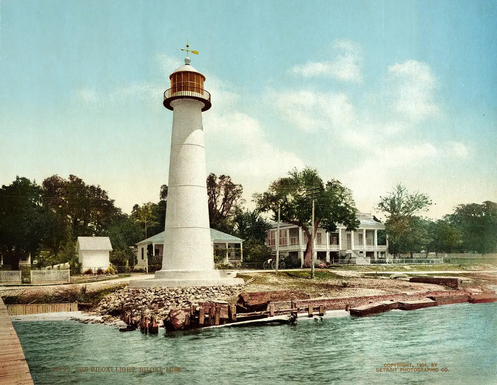
    An 1848 cast-iron tower marooned in the median of a four-lane highway, kept for sixty-three years by one family of women.

    0.5–1 hoursFree to see and photograph from the street or the beach. Climbing the tower carries a small fee when climbs are running.

  • Historic site

    A low historic brick fortification standing at the edge of calm coastal water
    Free

    Fort Massachusetts

    A brick coastal fort on a barrier island, held during the Civil War by one of the first Black regiments in United States service.

    0.5–1 hoursFree. There is no charge for the fort or for landing on the island — the cost of the visit is the ferry ticket or the charter.

  • Beach

    Low evening sun over a wide empty beach with wet sand reflecting the sky
    Free

    Biloxi Beach

    Miles of public sand along the beach highway, free to use, shallow a long way out, and with no shade anywhere on it.

    1–4 hoursFree. The sand is public along its whole length and parking along the frontage is free in most places.

  • Nature preserve

    A timber boardwalk curving through dense swamp woodland above still dark water
    Free

    Gulf Islands National Seashore — Davis Bayou

    The only piece of the national seashore in Mississippi with a road to it: oaks, boardwalks, a bayou and a staffed visitor centre.

    1–3 hoursFree to enter and to walk. Camping is charged.

  • Nature preserve

    Aerial view of a narrow strip of undeveloped pale sand between green water and dense pine forest
    Free

    Deer Island

    Four hundred acres of state-owned pine and marsh a short paddle off the beach road, with no ferry, no dock and nothing built on it.

    2–5 hoursFree. The cost is the boat.

  • Neighbourhood

    Rows of boats moored in a marina basin on flat water at first light with a low skyline beyond
    Free

    Gulfport

    Mississippi's second city, twelve miles west along the beach road, holding the Ship Island ferry, the airport and the aquarium.

    1–5 hoursFree to visit. Jones Park and the harbour cost nothing; the ferry, the aquarium and the casinos do not.

Straight answers

Questions people actually ask

How do you get to Ship Island from Biloxi?

By passenger ferry, and it sails from Gulfport rather than Biloxi. The boat leaves from Jones Park on the Gulfport harbourfront, roughly a twenty-minute drive west along US 90 from the Biloxi Lighthouse, and the crossing takes about an hour. There is no bridge, no road and no scheduled alternative. Outside the ferry season the only way out is a private boat or a chartered one.

When does the Ship Island ferry run?

Seasonally. The Park Service describes service as operating from around the middle of March through October, with more sailings in high summer than in the shoulder weeks at either end. From November to early March there is no public ferry at all. Times and fares are reset each season and published by the concessionaire, so check the current schedule and book ahead for a summer weekend rather than turning up.

Is the water at Ship Island clear?

On the Gulf side, yes, and that is the whole point of going. The island's south shore faces the open Gulf and the water there runs clear green with small breaking surf. The north shore, facing the mainland across the Mississippi Sound, is the same shallow brown-green water you see from the beach road in Biloxi. The swim beach and the facilities are on the Gulf side.

How long do you get on Ship Island?

Usually about four hours, inside a commitment of roughly seven hours door to door once you add the drive to Gulfport and an hour's crossing each way. The exact island time depends on which sailing you take and what the return is set at that day. It is enough for the fort, a long swim and lunch. It is not enough to be relaxed about any of the three if you dawdle.

Is there food on Ship Island?

There is a small concession near the swim beach selling drinks and snacks in season, plus chair and umbrella rental. Treat it as a backstop rather than a plan. Stock is finite, a full ferry empties a small counter quickly, and there is nothing else on the island. Bring your own water in particular, because dehydration in four hours of unbroken sun is the most common problem out there.

Can you camp on Ship Island?

Not at present. Camping on Ship Island is currently prohibited, and the ferry is a day service in any case. Primitive camping is permitted on some of the other federally owned barrier islands in Gulf Islands National Seashore, which are reached only by private boat and have no facilities, no fresh water and no shelter. Check current regulations with the National Park Service before planning anything of the kind.

Why is Ship Island one island again?

Because the Army Corps of Engineers put the sand back. Hurricane Camille cut the island in two in August 1969, creating the gap known as Camille Cut, and for about fifty years charts showed East Ship and West Ship as separate islands. The Corps closed the breach by pumping sand into it and completed the first phase in early 2019. The fort, the pier and the swim beach are all on the western end.

Is Ship Island worth it with young children?

Yes, with honest expectations. The swim beach is shallow at the edge, there are restrooms and showers, and the ferry crossing entertains most children on its own. The difficulty is the fixed timetable, the full sun and the walk across the island with everything you are carrying. Take a pushchair only if you are happy to carry it up the boardwalk, and put the youngest ones in the shade of a pavilion in the middle of the afternoon.