Skip to content
Search
Menu

We earn a commission if you book through this link. You pay the same price.

A wide empty stretch of pale sand running away beside shallow clear water with almost nobody on it
U.S. Navy photo

Park

Ship Island

Last updated

A barrier island twelve miles offshore with clear Gulf water, a brick fort, and an anchorage that shaped three centuries here.

Photo: U.S. Navy photoPublic domain

Closed at the moment

Sections of beach are closed seasonally for ground-nesting birds. Closures are posted on the island and their boundaries move year to year.

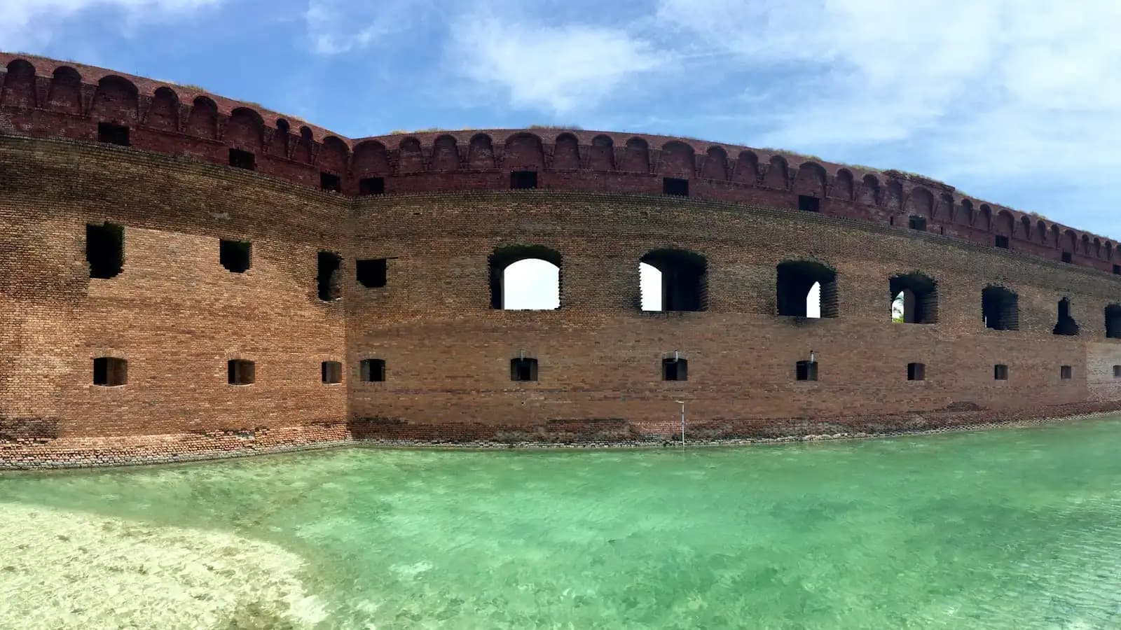
Ship Island is a low bar of quartz sand about twelve miles out from the mainland, held together by sea oats and beach grass, with a brick fort at its western end and the open Gulf of Mexico breaking along its southern shore. It is the answer to the question every visitor eventually asks on the beach road, which is where the clear water went.

The sand is not local. Barrier islands along the northern Gulf are built from material that rivers carried down from the continental interior over a very long time, sorted by waves into fine pale quartz and pushed westward along the coast by the prevailing drift. Walk it barefoot and it squeaks, which is what clean quartz does. Everything growing on it is salt-tolerant and low, because nothing tall survives out there.

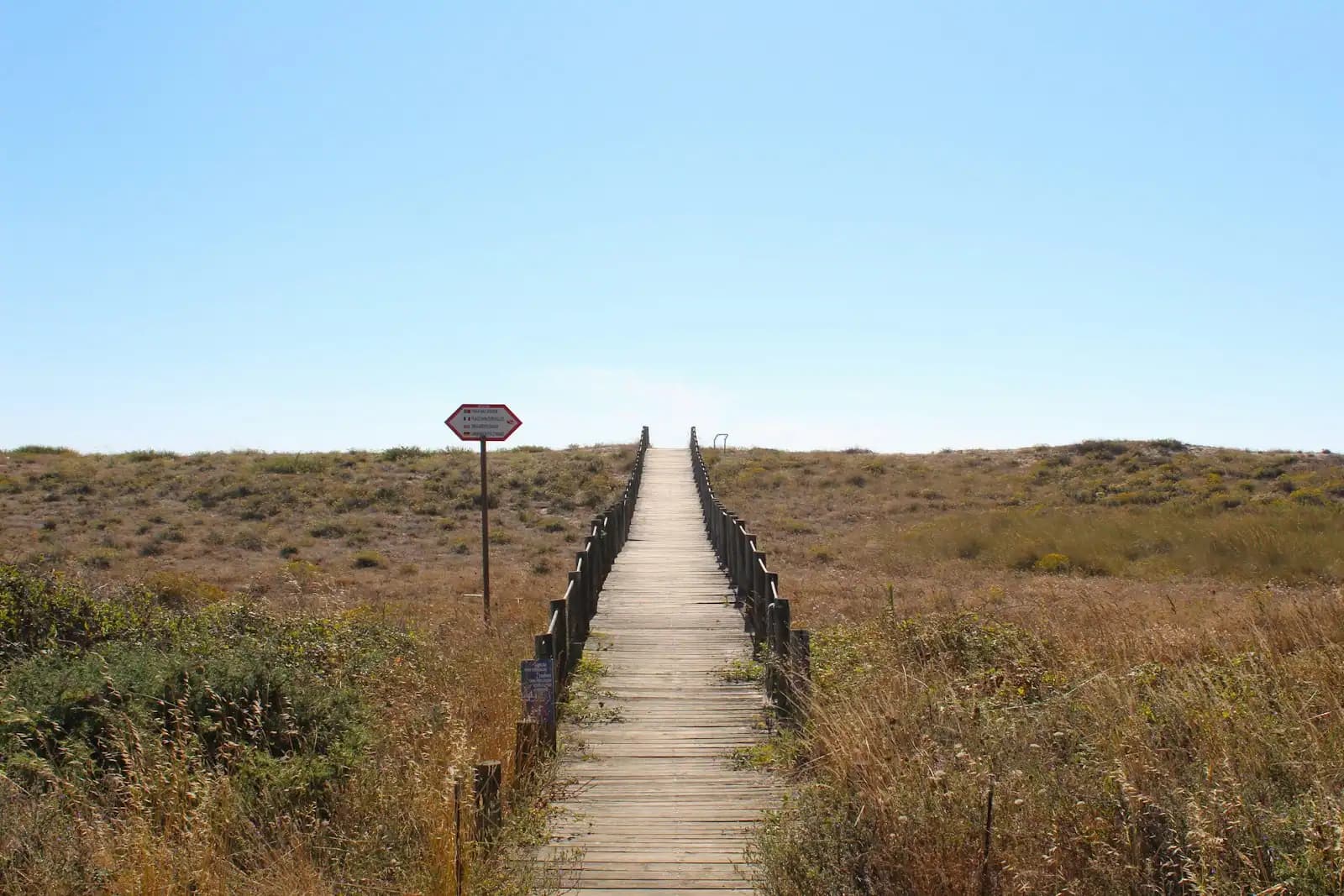
The island exists in two halves in the visitor's mind. The north shore faces the mainland across the Mississippi Sound and is where the ferry pier and the fort are. The south shore faces the Gulf and is where the swim beach is, the water changes colour, and people finally understand what they came for. A timber boardwalk crosses between them, a few hundred yards of raised walkway over dune and scrub with no shade on it at all.

What makes Ship Island more than pretty is the water beside it rather than the sand on it. The leeward side carries the only worthwhile deep anchorage between Mobile Bay and the mouths of the Mississippi, and that single piece of geography is why a French expedition anchored here in 1699 at the beginning of European settlement on this coast, why a British fleet assembled here before marching on New Orleans in 1814, and why the United States eventually built a fort on it.

Gulf Islands National Seashore administers the island now. There is no road, no bridge, no accommodation and no shop beyond a single seasonal concession. You come by boat, you get a few hours, and you leave on the same boat.

Getting there and parking

By boat, and only by boat. There is no bridge to Ship Island and no road on it.

The public route is the seasonal passenger ferry operated by an authorised National Park Service concessionaire, which sails from Jones Park on the Gulfport harbourfront rather than from anywhere in Biloxi. That is about a twenty-minute drive west along US 90 from the Biloxi Lighthouse, and the crossing takes roughly an hour. Service runs from around the middle of March to the end of October; outside that window there is no scheduled way out.

Private boats can land, and many do on a calm summer weekend, anchoring off the north shore or coming alongside where permitted. The Sound is shallow and the channels matter, so this is a trip for somebody who knows the water rather than an afternoon in a rented pontoon.

Charter is the third option and the most expensive one. Several Biloxi and Gulfport operators will run a group out, which buys you your own schedule and the ability to go in the ferry's off-season.

Three hundred years of caring about one deep hole in the water

The Mississippi Sound is shallow almost everywhere. Ship Island's leeward side is not, and in the age of sail that made this unremarkable sandbar the most strategically useful place between Mobile Bay and the passes of the Mississippi River.

The French named it for exactly that. Ile aux Vaisseaux — island of ships — because it was where ships could actually lie. Iberville's expedition came to anchor here in 1699 at the start of the French colonial effort on the Gulf, and supplies, soldiers and settlers moved through this anchorage while Biloxi, Mobile and New Orleans were still ideas.

More than a century later the British came for the same reason. In the winter of 1814 the fleet assembling for the campaign against New Orleans gathered at Ship Island, and troops were moved from here towards Lake Borgne and the battle that followed in January 1815. The island had no defences at the time. That, in short, is why the United States later decided to build a fort on it.

None of this is visible from the swim beach. It is all in the water on the other side of the island, and the only physical trace ashore is the fort itself. But standing on the north shore looking back at the mainland, with the ferry tied up and the Sound going flat, it is not hard to see what three centuries of navigators saw here.

The island is not where it used to be

A barrier island is not a fixed object. It is a pile of sand in transit, and the Mississippi chain moves steadily westward as waves strike the shoreline at an angle and carry material along it. The islands lose sand off their eastern ends and gain it at their western ones, which over a century adds up to an island that is somewhere else.

They have also been shrinking. The Mississippi barrier islands hold less land than they did a hundred years ago, for reasons that include storms, the dredged ship channels cut through the Sound, and the reduction in sand arriving from upstream. This is not an abstraction: it is why sand placement projects out here are argued on flood-protection grounds. An intact barrier island takes the first bite out of a surge that would otherwise reach the beach road.

Hurricane Camille cut this island in two in 1969 and the Corps of Engineers put the sand back fifty years later — the story is told in full on the Ship Island category page. The thing to carry out there with you is simpler. The shoreline you walk on is a working coastal process with a fort standing on it, and the next big storm will rearrange some of it.

Everything a visitor uses is at the western end: the pier, the fort, the pavilions and the swim beach. The rest of the island is bare sand and grass with no facilities of any kind.

Ground-nesting birds, and the roped-off sand

Sections of beach out here are closed during the nesting season, and the reason is that several of the birds using this island lay their eggs directly on open sand with no nest worth the name.

Least terns and black skimmers nest in colonies on bare ground above the tideline. The eggs are the colour of the sand and are effectively invisible until you have stepped on one. Adult birds will lift off and mob an intruder, which looks dramatic and is costly for them: every minute a colony is in the air is a minute the eggs and chicks are exposed to sun and to gulls. The Park Service ropes off nesting areas and posts them, and those closures move year to year with the colonies.

The practical rules are short. Stay out of posted areas. Keep to the boardwalk and the marked swim beach. If birds start calling and flying at you, you are too close and the correct response is to walk away from them rather than through them. Do not let a child chase a flock along the shoreline, however much fun it looks.

Outside the closures there is a lot to look at. Brown pelicans work the shallows, shorebirds feed along the wrack line, and in spring and autumn this island sits under a migration route where exhausted songbirds make landfall after crossing the Gulf.

What the hours on the island actually feel like

You land on the Sound side at a pier beside the fort. The fort is worth doing first, while you are fresh and while the interior is cool, and it takes twenty minutes to half an hour unless a ranger talk is running.

Then the boardwalk. It is a few hundred yards of raised timber across the middle of the island, fully exposed, and it is where everybody's optimism about carrying four bags and a cool box meets reality. Take one trip, not two.

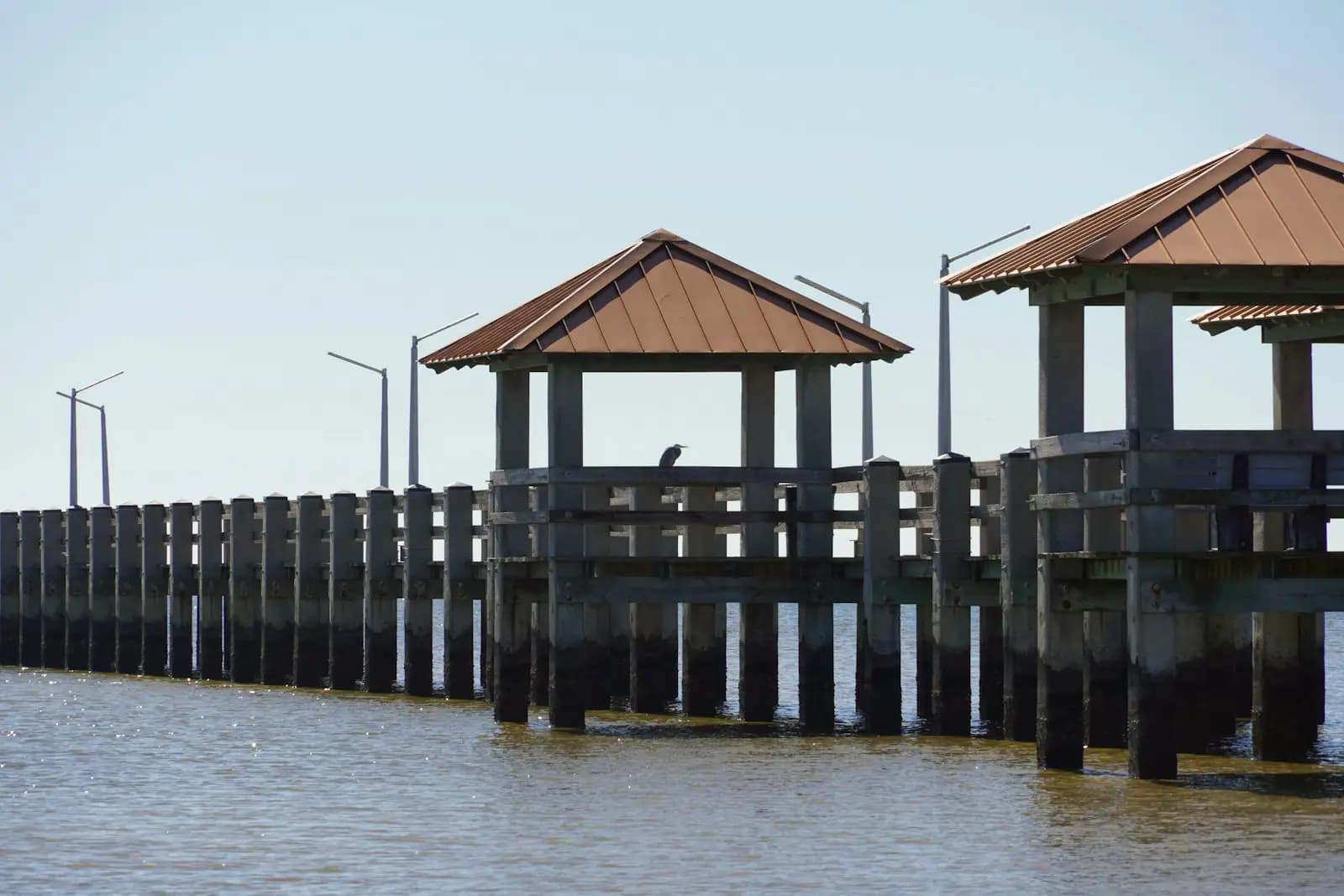
The Gulf side is where the day happens. The swim beach sits in front of the pavilions, with restrooms, outdoor showers and a small seasonal concession behind it. The water is clear green, deepens sooner than the mainland does and carries small surf, and there is a marked swim area with seasonal lifeguard cover. Beyond the marked area you are on an unguarded open coast twelve miles from a hospital, which is worth remembering before anybody swims out to look at something.

Realistically you get about four hours ashore, which is enough to see the fort, swim properly, eat and still be at the pier early rather than sprinting for it. The heat between noon and three in July is serious and the pavilions are the only relief. Plan to be under cover or in the water in that window, and do the walking at either end of the day.

Near Ship Island

Straight-line distances, so allow more on the road — the island is long and has one main parkway.

  • Historic site

    A low historic brick fortification standing at the edge of calm coastal water
    Free

    Fort Massachusetts

    A brick coastal fort on a barrier island, held during the Civil War by one of the first Black regiments in United States service.

    0.5–1 hoursFree. There is no charge for the fort or for landing on the island — the cost of the visit is the ferry ticket or the charter.0.7 mi away

  • Nature preserve

    A timber boardwalk curving through dense swamp woodland above still dark water
    Free

    Gulf Islands National Seashore — Davis Bayou

    The only piece of the national seashore in Mississippi with a road to it: oaks, boardwalks, a bayou and a staffed visitor centre.

    1–3 hoursFree to enter and to walk. Camping is charged.15.7 mi away

  • Neighbourhood

    Rows of boats moored in a marina basin on flat water at first light with a low skyline beyond
    Free

    Gulfport

    Mississippi's second city, twelve miles west along the beach road, holding the Ship Island ferry, the airport and the aquarium.

    1–5 hoursFree to visit. Jones Park and the harbour cost nothing; the ferry, the aquarium and the casinos do not.12.8 mi away

  • Nature preserve

    Aerial view of a narrow strip of undeveloped pale sand between green water and dense pine forest
    Free

    Deer Island

    Four hundred acres of state-owned pine and marsh a short paddle off the beach road, with no ferry, no dock and nothing built on it.

    2–5 hoursFree. The cost is the boat.13 mi away

Ship Island: common questions

Why is Ship Island called Ship Island?

Because ships could anchor there and almost nowhere else nearby. The leeward side of the island holds deep water in a Sound that is shallow almost everywhere else, making it the usable anchorage between Mobile Bay and the mouths of the Mississippi. French navigators named it Ile aux Vaisseaux, island of ships, and the English translation stuck. That one piece of geography is the reason the island appears in three centuries of Gulf history.

Is Ship Island part of a national park?

Yes. It is administered by the National Park Service as part of Gulf Islands National Seashore, which stretches along the northern Gulf coast through Mississippi and into Florida. There is no entrance fee to land on the island — what you pay for is the boat. Park rules apply ashore, including seasonal closures of bird nesting areas and a current prohibition on camping.

Are parts of Ship Island closed to visitors?

Seasonally, yes. Least terns, black skimmers and other colonial birds nest directly on open sand here, and the Park Service ropes off and posts the nesting areas while the eggs and chicks are vulnerable. The boundaries move year to year as the colonies do. Stay on the boardwalk and inside the marked swim beach, and back away rather than walk on if birds start calling and flying at you.

Is there any shade on Ship Island?

Almost none. The island carries low salt-tolerant grasses and scrub and nothing tall enough to sit under. Your options are the two pavilions at the swim beach, the interior of the fort and whatever you carried across the boardwalk yourself. Between noon and three in high summer that matters a great deal, so plan to be under cover or in the water in that window and do your walking at either end of the day.
Can you take a private boat to Ship Island?

Yes, and plenty of people do on calm summer weekends, anchoring off the north shore. It is not a beginner's trip. The Mississippi Sound is shallow with channels that matter, the crossing is around twelve miles of open water, and conditions change quickly when a summer thunderstorm builds. Charter is the middle option: a local operator runs you out on your own schedule, including outside the ferry season, at a considerably higher price.