Neighbourhood
Free
Point Cadet
The headland where the canneries stood for a century and where Mississippi's coastal casino era began in 1992.
1–3 hoursFree to walk. The museum and the schooner sailings are ticketed separately.0.9 mi away

Nature preserve
Last updated
Four hundred acres of state-owned pine and marsh a short paddle off the beach road, with no ferry, no dock and nothing built on it.
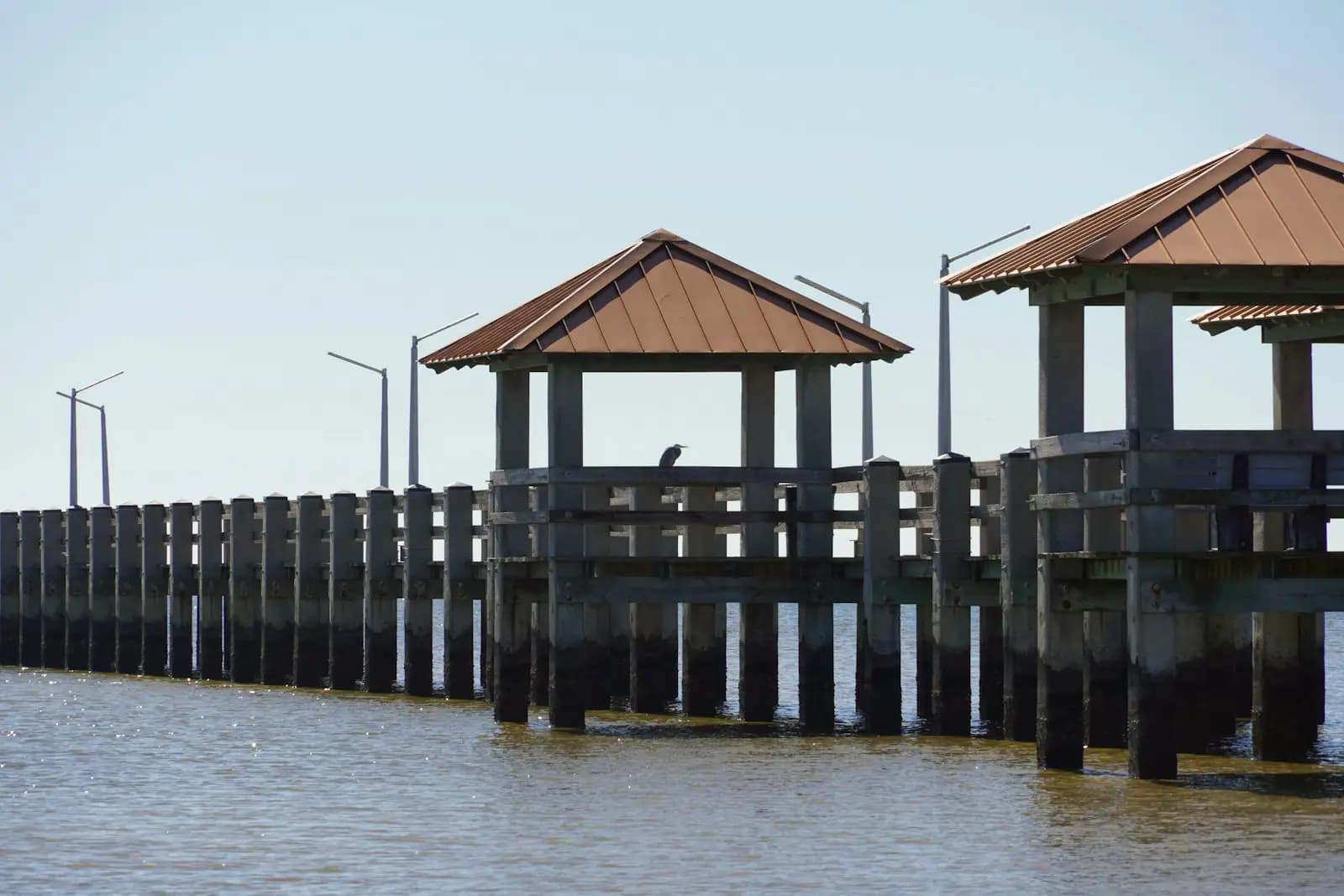
Photo: BreaultPublic domain
Stand anywhere along the Biloxi beach road and look south. The low green line lying end-on to the city is not Ship Island, which is eleven miles out and invisible on most days. It is Deer Island, it is the closest island to the Mississippi mainland, and the fact that you can pick out individual pines on it is what gets people into trouble.
There are about four hundred acres out there: slash pine and live oak on the sandy high ground, needlerush and cordgrass on the Back Bay side, a thin south-facing shore of pale sand, ospreys, wading birds and ten listed species of plants and animals. There is nothing else. No pier, no ferry, no shop, no shade you can count on, no fresh water and no marked trail. The island once formed part of the mainland rather than growing as a barrier island offshore, which is why it lies so much closer in than Horn or Petit Bois.
That emptiness was bought. Through the 1990s the island was a live development question on a coast that had just legalised dockside gaming, and in May 2002 the State of Mississippi purchased the bulk of it to settle the matter. It is now a state coastal preserve. In 2011 sand-filled geotextile tubes were sunk along parts of the shoreline as dune cores, because the island has been losing ground to storms and to the wakes of everything that uses the channel behind it.
That channel is the catch. The Biloxi Ship Channel runs between Deer Island and Point Cadet, and it carries commercial traffic, tugs pushing barges and the casino boats' service fleet. The crossing from the harbour is a few hundred yards of moving water with right-of-way that is not yours. Paddlers make it in flat conditions every week of the year. Paddlers also get caught in it on a falling tide with an afternoon southerly building, which is a different proposition entirely.
No road reaches Deer Island and no scheduled boat serves it. Every arrival is a private one.
Paddlers usually launch from Point Cadet at the eastern tip of the Biloxi peninsula, from the small craft harbour beside the lighthouse, or from Front Beach in Ocean Springs if they want the island's eastern end. The Point Cadet crossing is the shortest and also the one that puts you directly across the Biloxi Ship Channel, so it is the one that demands the most attention to what is coming up the channel.
If you are not paddling, the practical options are your own shallow-draft boat, a rented pontoon from one of the Back Bay liveries, or an arrangement with a local captain to drop and collect. Landing means stepping off into knee-deep water onto sand; there is nowhere to tie up.
Nothing scheduled goes to Deer Island. You get there on your own boat, on a rented kayak or paddleboard, or with a local captain who agrees to drop you and come back, which is an arrangement you make privately rather than book online.
The usual launches are Point Cadet at the eastern tip of the Biloxi peninsula, the small craft harbour beside the lighthouse, and Front Beach in Ocean Springs for the eastern end of the island. From Point Cadet the water gap is narrow. It is also the Biloxi Ship Channel, dredged and marked, used by tugs with barges and by the vessels that service the casino fronts, and a loaded tow does not stop or swerve for a paddleboard.
Three rules that local paddlers actually follow. Cross at right angles and get it over with rather than angling along the channel. Go in the first hours after sunrise, when the Sound is usually glass and the afternoon sea breeze has not filled in. Tell somebody the plan, because there is no phone signal guarantee and no one on the island to notice you did not come back.
If any of that reads as more commitment than you wanted, that is the honest answer: for most visitors Deer Island is scenery, not an itinerary.
The south shore facing the Mississippi Sound is the part worth the crossing: a narrow strip of sand, driftwood, shell hash and a horizon with no buildings in it, which on this coast is rare enough to be the whole point. Behind it the ground rises into pine and oak scrub, and behind that the island turns to marsh on the Back Bay side.
It is a working piece of coastal ecology rather than a park. Expect mosquitoes and biting flies from May through October, ticks in the scrub, no shade on the beach at midday and no drinking water anywhere. Bring everything, take everything back, and assume nobody will come past with a spare bottle.
Birds are the reliable reward. Ospreys nest here, herons and egrets work the marsh edge, and shorebirds use the sand spits at either end. Wading birds are easier to get near from a kayak than on foot.
The erosion is visible. Look for the geotube cores under the sand where the shoreline has been built up deliberately, and for stumps and dead pine standing in salt water where it has not.
Mississippi legalised dockside gaming in 1990 and Biloxi rebuilt its waterfront around it within a decade. An undeveloped island in clear view of the beach road, minutes from the harbour, was never going to be ignored, and it was not: development proposals for Deer Island were live through that period.
The state's purchase of the island in May 2002 ended them. The stated purpose was to keep it as it is, and the practical effect is that Biloxi is a casino city with an empty island as its southern horizon. Whatever you think of the gaming industry's arrival here, the decision that kept this particular four hundred acres out of it was made deliberately and with public money.
Restoration has continued since. Storm surge, subsidence and boat wake have all taken shoreline, and the sand-filled tubes installed in 2011 were an attempt to hold the line on the most exposed stretches. The island is smaller than it was a century ago and the work is maintenance, not reconstruction.
Straight-line distances, so allow more on the road — the island is long and has one main parkway.
Neighbourhood
The headland where the canneries stood for a century and where Mississippi's coastal casino era began in 1992.
1–3 hoursFree to walk. The museum and the schooner sailings are ticketed separately.0.9 mi away
Marina

A working harbour of trawlers and charter boats on the Sound side, best at dawn when they leave and at four when they come back.
0.5–1.5 hoursFree to walk and watch. Boat trips, charters, fuel, ice and ramp use are charged by the operators.1.3 mi away
Beach

Miles of public sand along the beach highway, free to use, shallow a long way out, and with no shade anywhere on it.
1–4 hoursFree. The sand is public along its whole length and parking along the frontage is free in most places.1.4 mi away
Water feature

The sheltered estuary behind the peninsula, where the shrimp grow up and the fleet goes to hide from hurricanes.
0.5–4 hoursFree. Public ramps, bridges and shoreline access cost nothing, though some ramps may charge for launching.2.4 mi away
Where this place fits into a day, and the pages that plan one.
Guide hub

Biloxi is confusing for about an hour and then it makes complete sense. You arrive on a four-lane highway with water on one side and casino towers…
Guide hub
Almost everything on this list is on one road or reached from it. US 90 runs the length of the Biloxi peninsula with the Mississippi Sound on the…
Things to do
Twenty-six miles of white sand run along the Harrison County shoreline, unbroken from Biloxi through Gulfport and on towards Pass Christian, and…
Budget
Most coastal towns charge you for the privilege of arriving. A beach parking permit, a per-hour lot, a chair-and-umbrella concession that owns the…
Things to do

Biloxi is a port before it is a resort, and the boat trips reflect that. There is no fleet of glass-bottom catamarans here and no sunset booze…
Guide

Twenty-six miles of engineered sand, no surf, brown water and no shade. Here is how to use it well, where the real Gulf beaches are, and when to admit you want a different coast.
9 min readRhett Vuong
Guide
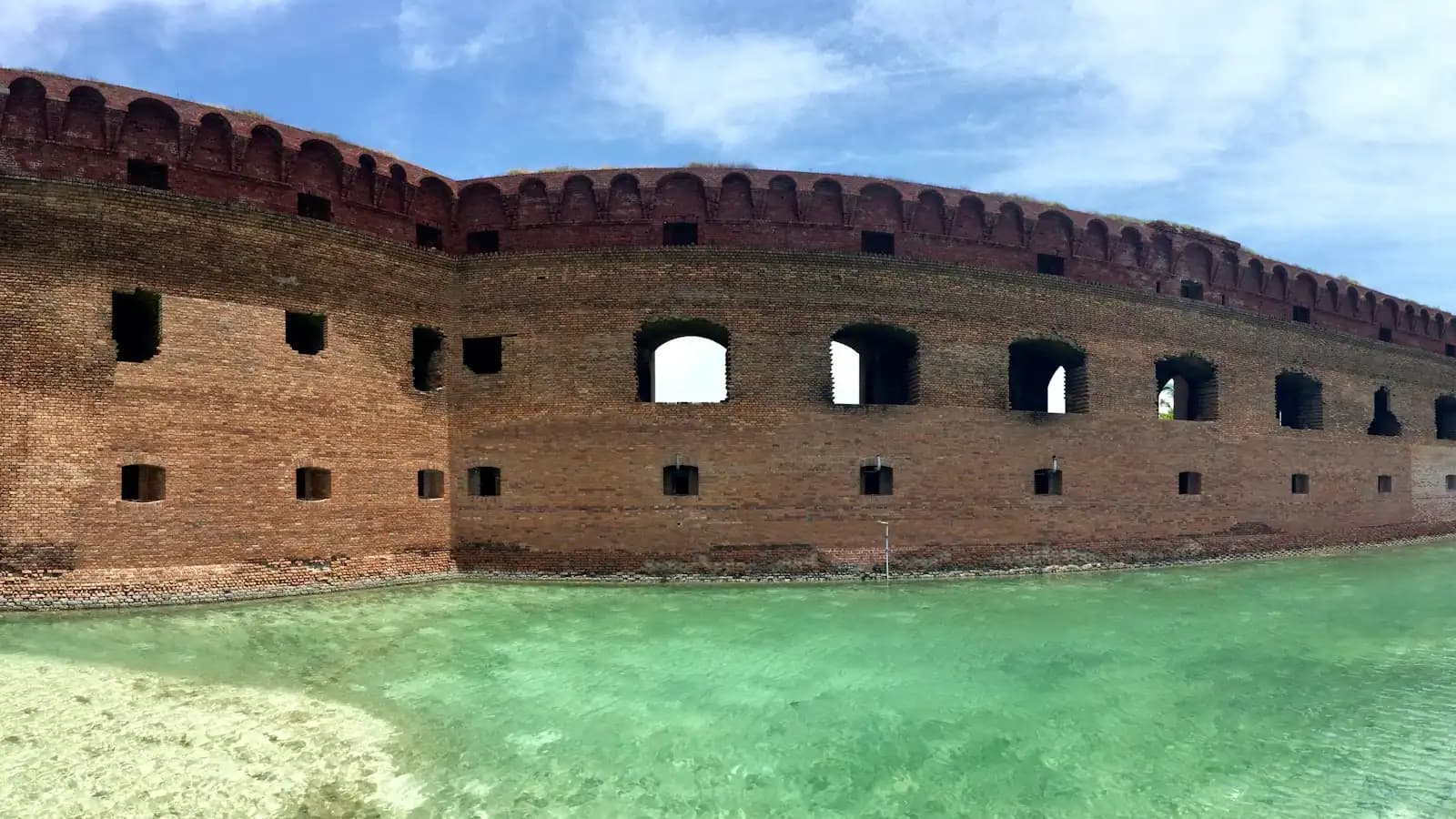
Twelve miles offshore, an hour on the boat, a brick fort standing in clear Gulf water, and almost no shade on the entire island. Plan it as an expedition.
9 min readRhett Vuong
Yes, during daylight, but only if you bring your own way across. Deer Island is a Mississippi Coastal Preserve with no ferry, no dock and no facilities, so access means a private boat, a kayak or paddleboard, or a local captain willing to drop you and return. There is no charge to be on the island. Landing means wading ashore onto sand, and everything you need for the day goes with you and comes back with you.
Close enough to see the trees clearly and far enough to matter. The water gap from Point Cadet at the eastern end of the peninsula is a matter of a few hundred yards, but the Biloxi Ship Channel runs through it, carrying tugs, barges and service traffic. Local paddlers cross it regularly in calm early-morning conditions. Doing it in an afternoon chop, on a falling tide, or without watching the channel is how people get into trouble here.
There is a narrow natural shore on the south side facing the Mississippi Sound: sand, shell, driftwood and an empty horizon. It is nothing like the groomed man-made strip along the beach road on the mainland. No lifeguards, no shade, no restrooms and no drinking water. The water is Sound water rather than open Gulf, so do not expect the clarity people travel to Ship Island for.
Because the state bought it. Development proposals circulated in the years after Mississippi legalised dockside gaming in 1990, and in May 2002 the State of Mississippi purchased most of the island specifically to keep it as it is. It is now managed as a coastal preserve, with restoration work including sand-filled geotextile tubes installed in 2011 to slow shoreline loss.