Skip to content
Search
Menu

We earn a commission if you book through this link. You pay the same price.

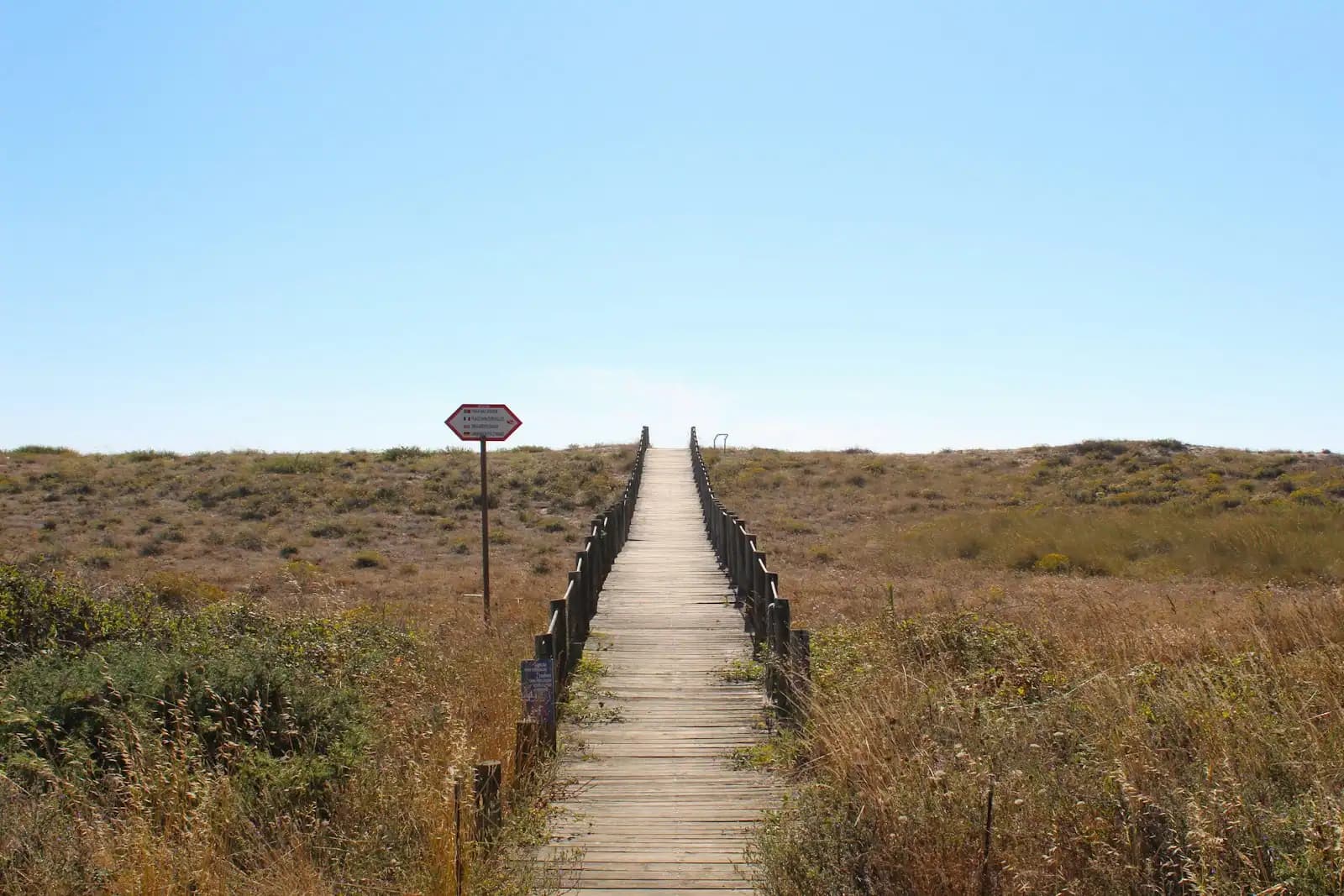
A timber boardwalk running out across low dune scrub towards the shore under a clear sky
Unsplash

Things to Do

Gulf Islands National Seashore: The Mississippi Half

Last updated

The Mississippi district of Gulf Islands National Seashore: five barrier islands, the Davis Bayou unit at Ocean Springs, and how you actually reach them.

A national seashore usually means a car park, a visitor centre and a path to the sand. The Mississippi district of Gulf Islands National Seashore is not that. It is five barrier islands lying ten to twelve miles out across the Mississippi Sound, one modest mainland unit on the far side of Biloxi Bay, and a single seasonal passenger ferry that serves exactly one of the islands. Everything else out there is reached by private boat or not at all, and that is not an oversight. It is the management intent.

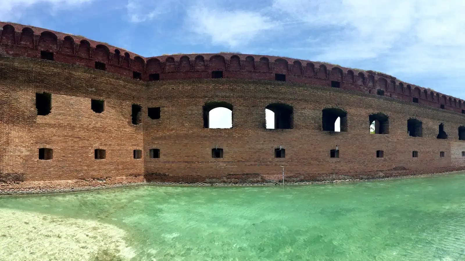
The islands are Petit Bois, Horn, East Ship, West Ship and Cat. Four thousand and eighty acres of Horn and Petit Bois were designated wilderness in November 1978, which is a formal legal status, not a descriptive adjective: no structures, no vehicles, no development, and no commercial ferry will ever land you there. Cat Island is partly privately owned and public access is correspondingly narrower. West Ship is the exception, with the pier, the fort, the concession and the boat from Gulfport, and it carries almost all of the district's visitors on its own.

On the mainland there is the Davis Bayou Area at Ocean Springs, about twenty minutes from the Biloxi Lighthouse across the bay. It is the only piece of the seashore in Mississippi you can drive to. There are live oaks and pines, a brackish bayou running out to the Sound, a campground with hookups, short trails and boardwalks, a boat launch and a visitor centre. It is not spectacular and it does not pretend to be. It is a quiet, shaded, genuinely pleasant hour, and it is free to walk into.

The thing to understand before you plan anything is the access gradient. Davis Bayou costs you a drive. West Ship costs you a ferry ticket and most of a day. Horn, Petit Bois, East Ship and Cat cost you a boat, competence in open water and a willingness to arrive somewhere with no shade, no fresh water, no facilities and no way to leave until you leave. The reward is the emptiest coastline in this part of the Gulf. The price is that you have to mean it.
Davis Bayou: the part you can drive to

A timber boardwalk curving through dense swamp woodland above still dark waterUnsplash
A timber boardwalk curving through dense swamp woodland above still dark water

If you have an afternoon and no boat, this is the answer, and it is the most consistently overlooked thing on the Mississippi coast.

The Davis Bayou Area sits on the Ocean Springs side of Biloxi Bay, which from most Biloxi hotels means crossing the bridge and turning south, twenty minutes at most. What you find is a piece of coastal woodland that looks nothing like the beach road: live oaks with Spanish moss, slash pine, palmetto understorey, and a brackish bayou winding out toward the Sound through spartina marsh.

There are short trails and raised boardwalks over the wet ground, a fishing pier, a boat launch that local anglers use to reach the Sound, and a campground with water and electrical hookups, which makes this the only developed camping in the seashore's Mississippi district. The visitor centre is where to ask about island conditions, ranger programmes and whether the ferry is running that week.

Take insect repellent. A brackish bayou in a warm climate is exactly what it sounds like, and the mosquitoes in still air from May to September are serious rather than notional. Alligators live here, as they do in every coastal bayou in Mississippi; keep dogs leashed and away from the water's edge, and do not go looking for one.

The wildlife is the reason to come. Herons, egrets, osprey, occasional bald eagles, and in autumn a genuinely good run of migrating songbirds coming off the Gulf.

Horn Island, and the painter who rowed out to it

Seabirds crossing low over small waves running up an empty beach at sunriseUnsplash
Seabirds crossing low over small waves running up an empty beach at sunrise

Horn is the island this coast is sentimental about, and the reason is a man in a rowing boat.

Walter Anderson lived in Ocean Springs and spent much of the last part of his life rowing a small skiff twelve miles out to Horn Island to work alone, sometimes for weeks, sleeping under the overturned boat. What he produced there is among the best American nature painting of the twentieth century, and the museum in Ocean Springs that holds it is a short drive from Davis Bayou. The story most often repeated on this coast has him tying himself to a tree to watch a hurricane come over the island. Take that as coast folklore rather than documented fact, but the underlying pattern is real enough: he went out there in conditions nobody else would, and he came back with the work.

The island itself is long, narrow and wooded along its spine, with slash pine, freshwater ponds and interior lagoons that hold alligators. Most of it is federally designated wilderness. There are no facilities, no water and no shelter, and the Park Service manages it to stay that way.

Two things worth knowing before romanticising it. Horn was used by the military during and after the Second World War, including for chemical and biological testing, and the island's history is not purely pastoral. And the insects in summer are, by universal local agreement, the worst on the coast. Go in October or April if you have the choice.

Reaching the islands that have no ferry

Local tips

  • Charter a captain rather than renting a boat. There is no drop-off shuttle to the wilderness islands in the way there is to Ship Island. What exists is a small number of local captains who will run you out and collect you, usually working out of the Biloxi Small Craft Harbor, Point Cadet or the Ocean Springs and Gulfport harbours. Ask specifically whether they will do a drop and pick-up rather than a sightseeing loop, and agree the collection time in writing.
  • Watch the wind, not the forecast headline. The Sound is shallow and it builds a short steep chop very quickly on a southerly. A twelve-mile run that is comfortable at seven in the morning can be genuinely unpleasant at four in the afternoon. Go early, come back early.
  • Kayaking to the barrier islands is a serious undertaking. People do it. It involves open-water crossings, shipping channels with commercial traffic, and no bail-out point. This is not the same activity as paddling the Back Bay, and it should not be attempted on holiday-rental equipment.
  • Deer Island is the sensible practice run. It sits a few hundred yards off the Biloxi shoreline, is state-owned and undeveloped, and gives you a taste of an empty island without twelve miles of open water in between.
  • File a plan with somebody ashore. Phone coverage offshore is patchy and unreliable on all of these islands. Tell somebody where you are going and when you will be back.
  • Take out what you take in. There is no rubbish collection anywhere on the barrier islands, and what blows off a boat stays in the Sound.

The Florida half is a different trip entirely

Gulf Islands National Seashore spans two states, and search results mix them constantly. It is worth knowing which one you are reading about.

The Florida district, around Pensacola and Santa Rosa Island, is the one most people picture: roads onto the barrier island, Fort Pickens with a campground and a drive-in entrance, long stretches of bright quartz sand, a visitor centre, and clear Gulf water directly accessible from a car park. It is roughly a two and a half hour drive east of Biloxi along Interstate 10, which makes it a long day trip at best and more sensibly an overnight.

The Mississippi district has one road-accessible unit, at a bayou, with no beach to speak of. That is the difference in a sentence.

If what you actually want is to walk from a car onto white sand facing open Gulf water, the honest advice is that Mississippi cannot give you that, and no amount of driving along US 90 will change it. Either take the ferry to Ship Island, which is the shorter and better answer, or accept a long drive east.

If what you want is the emptiest coast in the region, the Mississippi islands have something Florida stopped being able to offer decades ago, and it is out there twelve miles from a city of fifty thousand people.

Five islands and a bayou, ranked by how hard they are to reach

How they compare

PlaceHow you get thereWhat is out there
Davis Bayou, Ocean SpringsDrive; the only mainland unit in MississippiCampground, trails, boardwalks, boat launch, visitor centre, live oaks
West Ship IslandSeasonal passenger ferry from Gulfport, about an hourFort Massachusetts, swim beach, restrooms, pavilions, a small concession
East Ship IslandPrivate boat onlyUndeveloped sand and dune; nothing else at all
Horn IslandPrivate or chartered boat, about twelve miles of open waterDesignated wilderness, pine and lagoon interior, primitive camping
Petit Bois IslandPrivate or chartered boat, the longest run of the fiveDesignated wilderness, low and treeless, the emptiest of them
Cat IslandPrivate boat; partly in private ownershipDistinctive T shape, quiet beaches, limited public land

Two practical notes on that table. First, the run out to Horn or Petit Bois crosses genuinely open water in a shallow sound that builds a short, steep chop in a southerly breeze; this is not a flat-water trip in a small boat and people get into trouble misjudging it. Second, none of the wilderness islands has a dock. You land on a beach, which means wading your gear ashore and anchoring a boat where the weather can change on it.

Camping on a barrier island, honestly

Before you book

Primitive camping is permitted on the federally owned parts of the barrier islands, and it is one of the few genuinely wild coastal camping experiences left in the northern Gulf. It is also easy to underestimate.

There is no fresh water on any of these islands. Whatever you drink, you carry, and in July that is several litres per person per day, which is heavy. There is no shade on the treeless ones and only patchy shade on Horn. There is no shelter of any kind if the weather turns, no ranger station, no road and no way off except the boat that is coming back for you.

Insects are the thing that ends most first attempts. Mosquitoes and biting flies in still air from late spring to early autumn are severe enough that experienced campers here plan around wind direction rather than around views. A tent with a genuine bug mesh is not optional.

Then there is the weather. From June to November this is a hurricane coast, and a tropical system that is three days out when you leave the dock is a different problem when you are twelve miles offshore with no engine of your own. Check the marine forecast, not the city one, and treat any named system in the Gulf as a reason to cancel.

Camping on Ship Island is currently prohibited. Regulations for the other islands change, so confirm the current position with the National Park Service before you load a boat.

On the ground

Where to go

Every place below has its own page — hours, parking, what it costs and what to expect when you get there.

  • Park

    A wide empty stretch of pale sand running away beside shallow clear water with almost nobody on it

    Ship Island

    A barrier island twelve miles offshore with clear Gulf water, a brick fort, and an anchorage that shaped three centuries here.

    4–7 hoursThe island itself carries no entrance fee. Getting there does — the ferry is a ticketed service, and a private charter costs considerably more.

  • Museum

    A visitor standing in a gallery looking at exhibits mounted on a white wall

    Walter Anderson Museum of Art

    The murals a painter locked in a small room and told nobody about, fifteen minutes from the Biloxi casinos.

    1–2 hoursPaid admission, with reduced rates for students and children and free days offered periodically.

  • Historic site

    A low historic brick fortification standing at the edge of calm coastal water
    Free

    Fort Massachusetts

    A brick coastal fort on a barrier island, held during the Civil War by one of the first Black regiments in United States service.

    0.5–1 hoursFree. There is no charge for the fort or for landing on the island — the cost of the visit is the ferry ticket or the charter.

  • Neighbourhood

    A palm-lined pedestrian street with low shopfronts and cafe tables set out along it
    Free

    Ocean Springs

    Two miles east across Biloxi Bay: galleries, live oaks, a walkable main street and the site of the first French settlement on this coast.

    2–6 hoursFree to visit. Galleries are free to browse; the museum and Shearwater are separate.

  • Nature preserve

    A timber boardwalk curving through dense swamp woodland above still dark water
    Free

    Gulf Islands National Seashore — Davis Bayou

    The only piece of the national seashore in Mississippi with a road to it: oaks, boardwalks, a bayou and a staffed visitor centre.

    1–3 hoursFree to enter and to walk. Camping is charged.

  • Nature preserve

    Aerial view of a narrow strip of undeveloped pale sand between green water and dense pine forest
    Free

    Deer Island

    Four hundred acres of state-owned pine and marsh a short paddle off the beach road, with no ferry, no dock and nothing built on it.

    2–5 hoursFree. The cost is the boat.

Straight answers

Questions people actually ask

Which islands are in Gulf Islands National Seashore in Mississippi?

Petit Bois, Horn, East Ship, West Ship and Cat, plus the Davis Bayou Area on the mainland at Ocean Springs. Davis Bayou is the only part of the Mississippi district you can reach by car. West Ship Island has a seasonal passenger ferry from Gulfport. The rest are boat-access only, and parts of Horn and Petit Bois are federally designated wilderness with no facilities of any kind.

Can you drive to Gulf Islands National Seashore from Biloxi?

Only to the Davis Bayou Area in Ocean Springs, about twenty minutes from central Biloxi across the bay bridge. That unit has trails, boardwalks, a campground with hookups, a boat launch, a fishing pier and a visitor centre. Every island in the Mississippi district needs a boat. The seashore's road-accessible beaches are in the Florida district near Pensacola, a drive of roughly two and a half hours east.

How do you get to Horn Island?

By private or chartered boat, across about twelve miles of open water from the Mississippi coast. There is no ferry and there never will be, because most of the island is designated wilderness. Local captains working out of the Biloxi, Ocean Springs and Gulfport harbours will run a drop-off and collection if you ask specifically for that rather than a sightseeing trip. Agree the pick-up time before you go.

Can you camp on the Mississippi barrier islands?

Primitive camping is permitted on the federally owned portions of the barrier islands, but not on Ship Island, where camping is currently prohibited. There is no fresh water, no shelter, no facilities and no way off until your boat returns. Insects from late spring to early autumn are severe, and hurricane season runs June to November. Confirm current regulations with the National Park Service before planning a trip.

Is Davis Bayou worth visiting?

Yes, if you go expecting coastal woodland rather than a beach. It is quiet, shaded, free to walk into and full of wading birds, with short trails, raised boardwalks over the wet ground and live oaks draped in Spanish moss. It takes an hour or two. Bring insect repellent from May to September, keep dogs leashed, and treat the bayou edge as alligator habitat, because it is.

What is the Gulf Islands Wilderness?

A formal wilderness designation covering 4,080 acres on parts of Horn and Petit Bois islands, made in November 1978. It is a legal status rather than a description: no structures, no vehicles, no development and no commercial landings. In practice it means those two islands will stay as they are, and that anyone who visits arrives by their own boat and takes everything back out with them.

Is Gulf Islands National Seashore free?

Walking into the Davis Bayou Area costs nothing. Camping there carries a fee, and the ferry to West Ship Island is a commercial ticket sold by the authorised concessionaire rather than a park entrance charge. Landing on the other islands costs only whatever the boat costs you. Fees and ferry fares change, so check the National Park Service's current information before budgeting a trip.

When is the best time to visit the Mississippi barrier islands?

April and May, or late September into October. The insects are manageable, the water is warm enough to swim, and the air is not yet at the ninety-degree, high-humidity level of midsummer. July and August are hot, stormy in the afternoons and thick with mosquitoes and biting flies. Winter is calm and beautiful out there but the ferry does not run and the water is cold.