Skip to content
Search
Menu

We earn a commission if you book through this link. You pay the same price.

Spanish moss hanging in curtains from the spreading limbs of a live oak
Tim Burkitt

Historic site

Katrina Memorial

Last updated

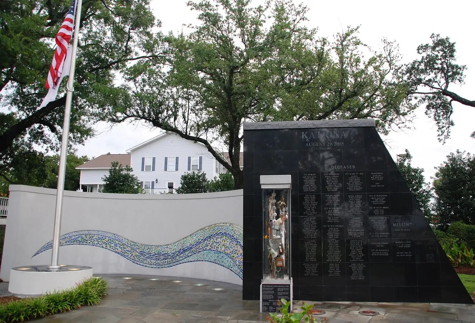
A monument on the Town Green carrying the names of people who died in this city on 29 August 2005.

Photo: Tim BurkittPublic domain

Hurricane Katrina came ashore on the Mississippi coast on the morning of 29 August 2005. On the Biloxi peninsula, which is low and narrow and has water on both sides, the surge rose more than twenty feet above normal levels and pushed across the beach road and through the neighbourhoods behind it. At least 228 people died in Mississippi as a direct result of the storm. In Harrison County, which contains Biloxi, 126 deaths had been confirmed within a fortnight, around thirty of them at a single apartment complex on the east end of the peninsula. Those counts were revised more than once in the months that followed, and different agencies still publish slightly different totals.

The memorial on the Town Green exists for those people. It was built after the first anniversary by local artists working with volunteers, including the crew of a television programme that was on this coast filming rebuilds, and it carries the names of the dead. About 170 of them are inscribed. Reading the names is what there is to do here, and it does not take long.

It stands on open ground on the north side of US 90, a short walk from the Biloxi Lighthouse and the visitor centre, under oaks that survived the storm. The setting is deliberate. This is the stretch of the city the water crossed, and almost everything a visitor sees along the beach road today was built, rebuilt or repaired after 2005.

If you are staying on this coast, it is worth twenty minutes early in your trip rather than late. A great deal of what you will be told about Biloxi over the following days — why the casinos sit on land, why so few old buildings remain between the highway and the water, why the Vietnamese-American shrimping community rebuilt where it did — makes more sense once you have stood here and understood that the storm is not background. It is the dividing line the city still measures from.
Getting there and parking

The Town Green lies on the north side of US 90, the beach road, a short walk east of the Biloxi Lighthouse and beside the city's visitor centre. Free parking is available at the visitor centre, which is the simplest place to leave a car.

On foot from the small craft harbour it is a few minutes west along the highway frontage. From the casino district at the eastern end of the peninsula it is a short drive or a long, hot walk in summer.

The highway is four lanes and the traffic moves. Use the signalised crossing at Porter Avenue rather than crossing where you happen to be standing.

What happened on this stretch of coast

Katrina made its final landfall as a Category 3 hurricane near the mouth of the Pearl River on the morning of 29 August 2005. Mississippi sat on the eastern side of the storm, which is where the surge goes, and the Mississippi Sound funnelled it into a shallow coastline with no elevation to absorb it.

High water marks on this coast exceeded 27 feet, the highest recorded at Pass Christian to the west. Through Biloxi the water was commonly measured at over twenty feet above normal. It carried the casino barges off their moorings, took out both the US 90 bridge to Ocean Springs and long sections of the beach road itself, and destroyed housing several blocks inland. Point Cadet, the low-lying eastern tip of the peninsula, was among the worst-hit parts of the city.

Statewide, at least 228 people died as a direct consequence of the storm. Many were in single-storey housing close to the water; many had stayed through previous hurricanes, including Camille in 1969, and had reason to believe they knew what a bad storm on this coast looked like.

The recovery is why so much of what a visitor sees here dates from after 2006. That is not a fact about architecture. It is a fact about what the storm removed.

What the memorial is

It is a monument on the Town Green inscribed with the names of people killed in this city, set on open grass a short distance back from the highway. There is no admission, no gate, no ticket office and no interpretive centre attached to it.

It was made in the year after the storm, by artists from this coast working with volunteers. The construction crew of a television rebuilding programme that was filming in Mississippi at the time helped put it up, which is a detail worth knowing because it tells you something true about the period: the coast was rebuilding in public, on camera, with whatever help arrived.

The list is of the dead, not of the damaged. Around 170 names are recorded. Local families still leave flowers at it, particularly around the end of August, and the city marks the anniversary each year. If you are here on 29 August, expect the green to be in use.

Treat it as you would any memorial to named individuals. Speak quietly, do not climb on anything, and leave the flowers where they are.

Practical notes

  • The memorial stands on the Town Green on the north side of US 90, close to the Biloxi Lighthouse and the city's visitor centre. Parking is free at the visitor centre.
  • US 90 at this point is four lanes of fast traffic. Cross at the signalised crossing rather than improvising, particularly if you have walked over from the beach side.
  • It is outdoors, open and unstaffed. There is no shelter, and this is a coast where a July afternoon is punishing and a thunderstorm builds fast. Early morning and the hour before sunset are the comfortable windows.
  • There is nothing to buy and nothing to book. Fifteen or twenty minutes is the honest measure of it.
  • If you want context before or after, the Maritime and Seafood Industry Museum and the Biloxi Lighthouse are both within a few minutes' walk, and both carry the storm's history as part of their own.

Where the rest of the record is

A single monument cannot hold this. If you want to understand what happened to the city rather than only to commemorate the people it lost, three places on this coast do the work.

The Maritime and Seafood Industry Museum, at the end of the peninsula, was itself destroyed in 2005 and rebuilt; its account of the fishing fleet runs straight through the storm, because the fleet's losses and the community's are the same story.

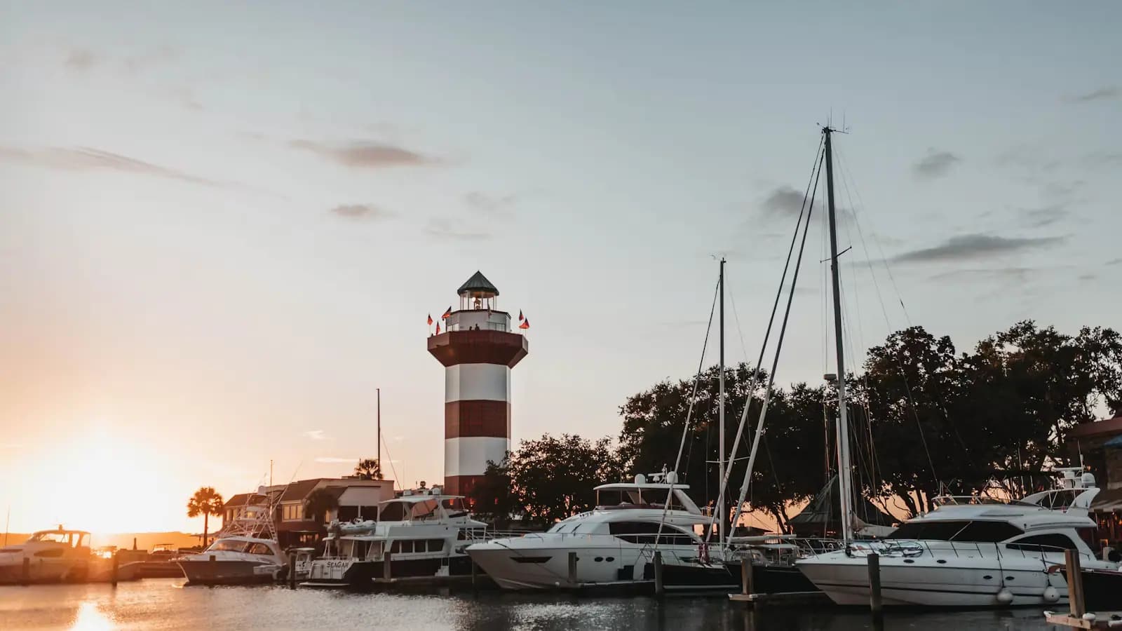
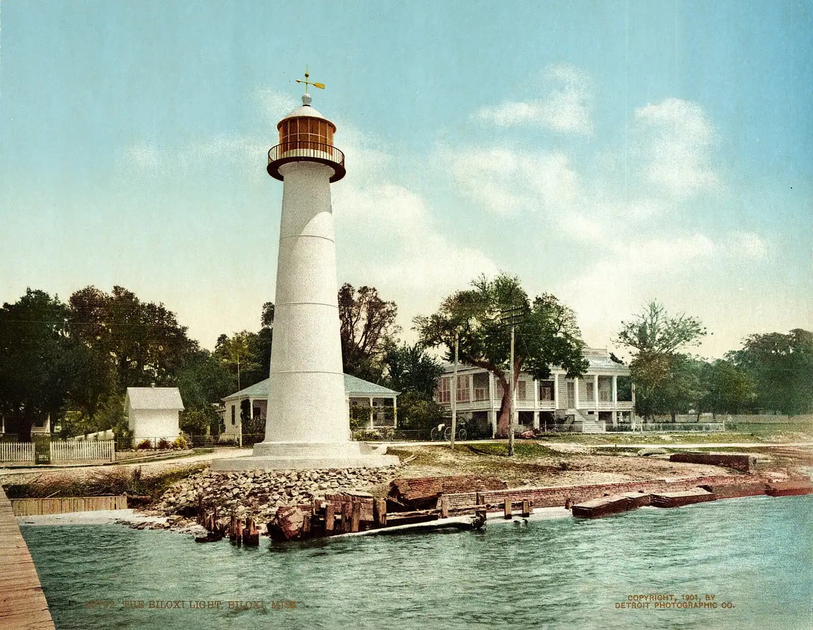
The Biloxi Lighthouse, standing in the median of the highway, took the surge above its door and did not come down. It was relit in a public ceremony in February 2010 and has served as the city's emblem of survival ever since, which is why it appears on so much civic material.

Point Cadet, the eastern tip, is where the storm did its worst in Biloxi and where the Vietnamese-American shrimping families who had settled from the late 1970s rebuilt. Walking or driving out there tells you more about the recovery than any exhibit.

Near Katrina Memorial

Straight-line distances, so allow more on the road — the island is long and has one main parkway.

  • Landmark

    A lighthouse rising above a low building at the water's edge
    Free

    Biloxi Lighthouse

    An 1848 cast-iron tower marooned in the median of a four-lane highway, kept for sixty-three years by one family of women.

    0.5–1 hoursFree to see and photograph from the street or the beach. Climbing the tower carries a small fee when climbs are running.0.8 mi away

  • Landmark

    A lighthouse rising above a low building at the water's edge
    Free

    Biloxi Visitors Center

    Free parking, restrooms and a staffed desk opposite the lighthouse, in a city where half of what you want to do is seasonal.

    15–45 minutesFree, including parking. Lighthouse climbs are ticketed separately when they run.890 ft away

  • Historic site

    A wooden house with wide verandahs shaded by mature trees

    Magnolia Hotel

    An 1847 hotel, the oldest left on this coast, which survives because the city picked it up in 1972 and moved it back from the water.

    15–45 minutesAny interior admission has been modest, and the exterior and site cost nothing.300 ft away

  • Museum

    Working fishing boats moored along a harbour dock under a heavy overcast sky

    Maritime & Seafood Industry Museum

    Canneries, schooners, net-making and the Vietnamese shrimp fleet: the museum that explains why Biloxi is here at all.

    1.5–2.5 hoursA modest admission charge for adults, with lower rates for children, students and seniors. Schooner sailings are priced separately.2 mi away

Katrina Memorial: common questions

Where is the Katrina Memorial in Biloxi?

It stands on the Town Green on the north side of US 90, the beach road, a short walk east of the Biloxi Lighthouse and next to the city's visitor centre. Parking at the visitor centre is free and is the easiest place to leave a car. The memorial is outdoors on open ground, with no gate and no admission charge, and it can be visited at any hour.

How many names are on the Biloxi Katrina Memorial?

Around 170 names are inscribed. They record people who died as a result of the storm on 29 August 2005. Casualty figures from Katrina were revised repeatedly through late 2005 and 2006 as people were identified and as indirect deaths were assessed separately, so published totals for the city, the county and the state do not all agree. Mississippi's confirmed direct death toll was at least 228.

How high did the water get in Biloxi during Katrina?

More than twenty feet above normal levels through Biloxi, with high water marks further west on the Mississippi coast exceeding 27 feet, the highest of them recorded at Pass Christian. The Biloxi peninsula is low and narrow with the Mississippi Sound on one side and the Back Bay on the other, so the water crossed it rather than stopping at the shoreline. Surge, not wind, is what did the damage here.

Is there a Katrina museum in Biloxi?

There is no single museum devoted to the storm, but its history runs through several places on this coast. The Maritime and Seafood Industry Museum at the end of the peninsula was destroyed in 2005, rebuilt, and tells the fishing fleet's story through it. The Biloxi Lighthouse, which survived, is the city's emblem of the recovery. Point Cadet, the hardest-hit part of the city, is where that recovery is most visible on the ground.